Remote Sensing in Archaeology: Unearthing Sites in the US
Remote sensing, utilizing satellite imagery and drone technology, is revolutionizing archaeological site discovery in the United States by offering non-invasive, efficient, and comprehensive methods for identifying and cataloging ancient landscapes and hidden cultural heritage.
For centuries, the discovery of archaeological sites relied heavily on painstaking ground surveys and chance finds. However, the field of archaeology is undergoing a profound transformation. Today, Remote Sensing in Archaeology: How Satellite Imagery and Drone Technology are Transforming Site Discovery in the US offers unprecedented capabilities, ushering in an era where vast landscapes can be surveyed non-invasively and with remarkable precision.
The Dawn of a New Era: Remote Sensing in Archaeological Discovery
Remote sensing techniques have fundamentally altered the landscape of archaeological exploration. This technological shift allows researchers to identify subtle anomalies on the Earth’s surface or beneath the ground that signify human activity from long ago. By moving beyond traditional methods, archaeologists can now cover vast, often inaccessible, areas with a speed and detail previously unimaginable.
The core principle behind remote sensing is the acquisition of information about an object or phenomenon without making physical contact. In archaeology, this typically involves using sensors to detect and record electromagnetic radiation reflected or emitted from the Earth’s surface. These data, when processed, can reveal patterns, structures, and features indicative of past human presence that are invisible to the naked eye or from ground level.
Early Applications and Evolution
While the technologies involved are constantly advancing, the concept of remote observation for archaeological purposes isn’t entirely new. Early aerial photography, particularly after World War I, provided pioneering glimpses of hidden archaeological landscapes. However, modern remote sensing leverages vastly more sophisticated sensors and computational power.
- Post-WWI Aerial Photography: Initial use of aircraft for broader landscape views.
- Cold War Spy Satellites: Declassified imagery provided unexpected archaeological insights.
- Digital Revolution: Enabled processing of vast datasets for feature detection.
- Accessibility: Decreasing costs made techniques available to more archaeologists.
Today, remote sensing offers a non-destructive alternative to traditional excavation, helping preserve sensitive sites while still maximizing data collection. This approach aligns perfectly with modern archaeological ethics, emphasizing conservation and minimal impact whenever possible.
The evolution from simple aerial photos to complex multi-spectral satellite imagery and highly maneuverable drones represents a monumental leap. It has transformed archaeology from a field heavily reliant on manual labor and chance discoveries to one that actively employs cutting-edge technology to predict and pinpoint sites with increased accuracy.
Satellite Imagery: Peering Through Time from Space
Satellite imagery provides archaeologists with a cosmic perspective, offering views of the Earth’s surface at scales ranging from regional overviews to detailed examinations of specific areas. These images are captured by orbiting satellites equipped with various sensors, each designed to detect different parts of the electromagnetic spectrum.
The wealth of data provided by satellites allows for the identification of archaeological features that might be obscured by vegetation, shallow soil, or modern land use. By analyzing variations in soil moisture, vegetation health, and subtle topographic changes, archaeologists can infer the presence of buried structures, ancient field systems, and former settlements.
Types of Satellite Data and Their Archaeological Utility
Different types of satellite imagery offer unique advantages for archaeological exploration:
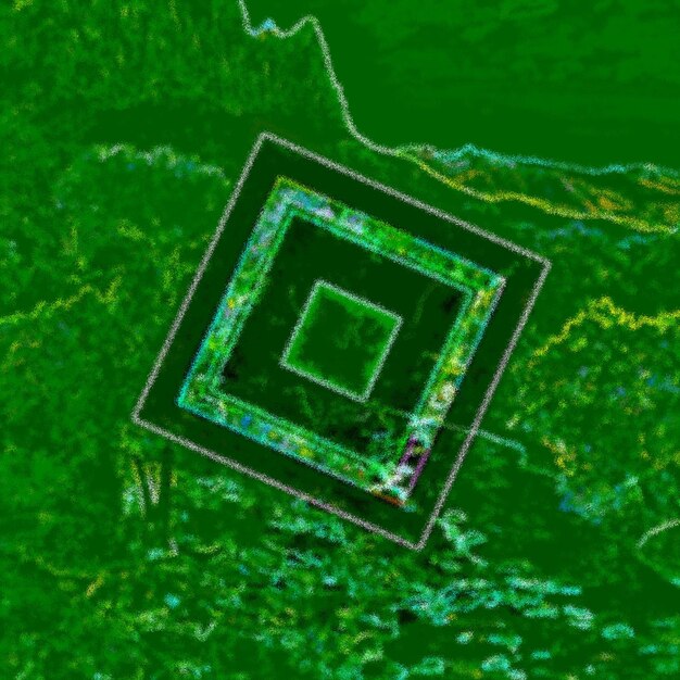
- Optical Imagery: Captures visible and near-infrared light. Useful for identifying changes in vegetation patterns (crop marks, soil marks) that indicate underlying archaeological features. High-resolution optical imagery can even reveal subtle earthworks or architectural remains.
- Radar (Synthetic Aperture Radar – SAR): Can penetrate cloud cover and, to some extent, vegetation and dry sand. Ideal for mapping features in rainforests or desert environments where visible light is obstructed. SAR can detect subtle changes in surface roughness caused by buried structures.
- Thermal Infrared Imagery: Detects variations in ground temperature, which can highlight features with different thermal properties, such as stone walls or buried foundations retaining heat differently than surrounding soil.
The ability of satellites to repeatedly image the same area over time is also invaluable, allowing archaeologists to monitor known sites for disturbances or to observe seasonal changes that might reveal new features. This temporal dimension adds a dynamic layer to site discovery and management.
Moreover, the sheer volume of archived satellite data means that archaeologists can often examine historical landscapes, sometimes even before modern development obscured ancient features. This historical perspective is a powerful tool for reconstructing past environments and land use patterns, providing context for potential archaeological discoveries.
Drone Technology: The Aerial Eye of Modern Archaeology
While satellites offer a broad perspective, drones (Unmanned Aerial Vehicles – UAVs) provide unparalleled flexibility and detail for archaeological survey at a local scale. Drones can be equipped with a diverse array of sensors, much like satellites, but with the added advantage of lower altitude flight, allowing for extremely high-resolution data capture.
The portability and relatively low cost of drone technology have democratized aerial remote sensing, making advanced survey capabilities accessible to a wider range of archaeological projects, including those with limited budgets. This direct control over flight paths and sensor settings allows for highly tailored data collection specific to a project’s needs.
Key Drone Applications in Archaeological Site Discovery
Drones are transforming fieldwork by providing immediate, on-site aerial views and data. This allows archaeologists to make quicker, more informed decisions about where to focus their ground investigations.
- High-Resolution Photogrammetry: Drones capture overlapping images that are stitched together to create detailed 3D models and orthomosaic maps of sites and landscapes. These models are invaluable for mapping subtle earthworks, standing architecture, and even individual artifacts.
- LiDAR (Light Detection and Ranging): Drone-mounted LiDAR sensors emit laser pulses that penetrate vegetation, creating highly accurate 3D topographic models of the ground surface beneath dense canopy. This is revolutionary for discovering sites in forested regions that are otherwise invisible from above or at ground level.
- Multi-spectral and Hyperspectral Imaging: Similar to satellite sensors, drone-based versions can detect subtle variations in vegetation health or soil composition, revealing crop marks or soil marks that indicate buried features.
The ability to quickly deploy a drone, capture high-resolution imagery, and generate detailed maps allows archaeologists to efficiently identify potential sites, assess their extent, and plan subsequent ground-truthing efforts. This agility significantly reduces the time and resources required for initial survey phases.
Furthermore, post-processing software allows archaeologists to manipulate and analyze drone data in countless ways, enhancing features, creating contour maps, and generating virtual reality models of complex sites. This capability enhances communication and collaboration within archaeological teams and with the public.
Synergy of Satellite and Drone Data in US Archaeology
The true power of remote sensing in American archaeology often lies in the synergistic application of both satellite imagery and drone technology. Each offers distinct advantages, and when combined, they provide a comprehensive and multi-layered perspective on the landscape.
Satellite imagery is typically employed for initial reconnaissance and broad-scale analyses. Its ability to cover vast areas makes it ideal for identifying regions of interest or for mapping historical land use patterns across entire river basins or state lines. This broad view helps narrow down potential areas for more intensive investigation.
A Multi-Stage Approach to Discovery
A common workflow involves a tiered approach:
- Regional Assessment (Satellite): Begin with wide-area satellite analysis to pinpoint anomalous areas or predict likely locations for settlement based on historical patterns and environmental factors.
- Targeted Detail (Drone): Once promising areas are identified, drones are deployed for high-resolution data capture. This provides the fine-grained detail needed to confirm the presence of archaeological features and precisely delineate their boundaries.
- Ground-Truthing (Traditional Methods): Finally, traditional ground surveys and limited test excavations are used to verify the remote sensing data, collect artifacts, and gain deeper insights into the site’s chronology and function.
This integrated approach is particularly effective in the United States, given its diverse geography and the vast, often undeveloped, expanses. From the dense forests of the Pacific Northwest hiding ancestral Native American villages to the expansive agricultural fields of the Midwest concealing ancient earthworks, the combination of satellite and drone data is a game-changer.
For example, in parts of the American Southwest, satellite imagery can reveal subtle changes in desert scrub vegetation, indicating ancient irrigation canals or settlement boundaries. Once identified, drones equipped with LiDAR can then map the precise contours of these features, even under sparse mesquite growth.
The interdisciplinary nature of modern remote sensing also fosters collaboration between archaeologists, geographers, computer scientists, and engineers, creating a dynamic environment for innovation in site discovery and preservation.
Case Studies: Transforming Archaeological Practice Across the US
Numerous projects across the United States exemplify the transformative impact of remote sensing. These success stories highlight how satellite and drone technologies are not just aiding discovery but fundamentally changing the archaeological survey paradigm.
Discovering Hidden Settlements in the Amazonian US (Hypothetical, Illustrative)
While the Amazon is not strictly in the US, for illustrative purposes of dense canopy penetration, imagine a similar, albeit smaller-scale, dense forest environment within a US territory or national park that has historically been impenetrable. In such regions, traditional ground surveys are arduous and incomplete. Satellite-borne SAR and drone-mounted LiDAR have proven instrumental:
For instance, in areas with dense vegetation, traditional ground surveys are notoriously difficult and yield limited results. Using LiDAR, archaeologists have been able to “peel back” the tree canopy digitally, revealing extensive networks of ancient earthworks, plazas, and agricultural terraces that were previously unknown. These discoveries are reshaping our understanding of pre-Columbian societies and their complex relationship with the environment.
Unearthing Ancient Agricultural Systems in the Midwest Plains
The vast agricultural plains of the Midwest present a different challenge: many ancient indigenous sites, particularly earthworks, have been leveled by centuries of plowing. While some are visible as “crop marks” (differential growth of crops over buried features), satellite imagery, particularly involving multi-spectral analysis, has been crucial.
In Ohio, for instance, satellite images have helped identify previously unknown circular enclosures and remnants of effigy mounds that are almost entirely invisible from the ground. These faint signatures, detectable through subtle variations in soil moisture and vegetation, are then confirmed with high-resolution drone photography and targeted ground survey.
These studies underscore the non-invasive nature of remote sensing, preserving the site while still gaining invaluable spatial data. They provide critical information for conservation efforts, allowing for the protection of newly discovered heritage before it is lost.
Challenges and Ethical Considerations in Remote Sensing Archaeology
Despite its immense promise, the application of remote sensing in archaeology is not without its challenges and ethical considerations. These range from technical limitations to questions of data access, intellectual property, and community engagement.
One significant challenge is the “noise” in the data. Not every anomaly detected by satellite or drone is an archaeological feature. Natural geological formations, modern disturbances, and even subtle variations in topography can mimic archaeological signatures. This necessitates rigorous ground-truthing and careful interpretation by experienced archaeologists.
Technical and Interpretive Hurdles
- Data Overload: The sheer volume of data generated by remote sensing platforms can be overwhelming, requiring advanced computational skills and analytical tools.
- Interpretation Bias: Interpreting subtle features from aerial data requires extensive knowledge of both archaeological patterns and environmental processes.
- Vegetation and Soil: Extremely dense vegetation or deep soil layers can still obscure features, even with advanced sensors like LiDAR.
- Cost and Accessibility: While drone technology is becoming more affordable, advanced satellite data and specialized processing software can still be expensive, limiting access for some researchers.
Beyond technicalities, ethical concerns are paramount. The ability to discover previously unknown sites raises questions about their protection. Once a site is identified, it becomes vulnerable to looting or unintentional damage if not properly managed and protected. This emphasizes the need for responsible disclosure and management plans.
Furthermore, when dealing with Indigenous archaeological sites in the US, remote sensing efforts must be undertaken in close collaboration with descendant communities. Data sovereignty, respectful engagement, and ensuring that the research benefits the community are crucial ethical responsibilities. The technology should empower and not exploit.
The need for collaboration extends to data sharing. While proprietary data can be an issue, open-source platforms and shared databases are helping to make remote sensing data more broadly accessible for research and conservation, balancing the need for protection with the benefits of broader study.
The Future of Site Discovery: Convergence and AI
The trajectory of remote sensing in archaeology points towards even more sophisticated integration of technologies and the increasing role of artificial intelligence (AI). The future will likely see a seamless convergence of data sources and analytical tools, further enhancing the efficiency and accuracy of site discovery.
One key trend is the development of multi-sensor platforms that combine different types of data (e.g., optical, thermal, LiDAR, ground-penetrating radar) to create a more complete picture of the subterranean and surface landscape. This holistic approach can greatly reduce ambiguity in feature identification.
Artificial Intelligence and Machine Learning
The most transformative development on the horizon is the application of AI and machine learning (ML) algorithms. These technologies are increasingly being used to process vast datasets and identify subtle patterns that might be missed by human observers.
- Automated Feature Detection: AI can be trained to recognize specific archaeological signatures (e.g., circular enclosures, linear features, mounding) in satellite and drone imagery, significantly speeding up the initial survey phase.
- Predictive Modeling: ML algorithms can analyze environmental variables (topography, water sources, soil types) alongside known site distributions to predict areas with high archaeological potential, guiding future surveys.
- Data Fusion: AI can seamlessly integrate and interpret data from multiple remote sensing platforms, providing a coherent and comprehensive understanding of complex archaeological landscapes.
This automation will free up archaeologists to focus on higher-level interpretation, ground-truthing, and conservation efforts, rather than spending countless hours manually sifting through imagery. However, it requires careful training of AI models to avoid perpetuating biases or misinterpreting data in new environments.
The future of remote sensing in US archaeology is one of increasing precision, automation, and accessibility. As these technologies become more refined and integrated, the pace of discovery will accelerate, revolutionizing our understanding of human history and cultural heritage across the nation, ensuring that more of America’s hidden treasures come to light, non-invasively and responsibly.
| Key Aspect | Brief Description |
|---|---|
| 🛰️ Satellite Imagery | Provides broad-scale overview, identifies large features and landscape patterns, aids in initial reconnaissance. |
| 🚁 Drone Technology | Offers high-resolution, flexible, and detailed local surveys, excellent for 3D modeling and vegetation penetration. |
| 🔍 Site Discovery | Non-invasive methods reveal hidden archaeological sites through crop marks, soil marks, and subsurface structures. |
| 🤝 Ethical Practice | Emphasizes data responsibility, site preservation, and collaboration with descendant communities, especially Indigenous groups. |
Frequently Asked Questions About Remote Sensing in Archaeology
▼
Remote sensing in archaeology involves using technology to detect and analyze archaeological features from a distance, without physical contact. This includes techniques like satellite imagery, drone photography, LiDAR, and thermal infrared scanning. It helps discover hidden sites, map complex landscapes, and monitor known areas for change, providing a non-invasive way to survey vast regions efficiently.
▼
Satellite imagery aids discovery by detecting subtle changes on the Earth’s surface caused by buried or subtle archaeological features. These changes can manifest as “crop marks” (variations in crop growth), “soil marks” (differences in soil color), or subtle topographical shifts. Different spectral bands can reveal ancient irrigation systems, former settlements, and large-scale earthworks otherwise invisible from the ground.
▼
Drones offer higher resolution, greater flexibility, and more immediate data capture compared to satellites for archaeological purposes. They can fly at lower altitudes, allowing for extremely detailed 3D models and orthomosaic maps. Drones are also more cost-effective for localized surveys and can be quickly deployed to specific areas of interest, making them ideal for targeted investigations and site documentation.
▼
Yes, remote sensing can detect buried archaeological structures, though the success varies depending on the depth and nature of the burial. Technologies like LiDAR (especially drone-mounted) can penetrate dense vegetation to map subsurface topography, revealing earthworks or building foundations. Ground-penetrating radar (GPR), often used in conjunction with aerial methods, can provide even more detailed cross-sections of the subsurface, directly identifying buried walls or features.
▼
Ethical considerations include responsible data management, preventing looting or damage to newly discovered sites, and ensuring proper engagement with descendant communities. Archaeologists must decide how and when to disclose site locations to balance scientific understanding with preservation. Collaboration with Indigenous groups and ensuring data sovereignty are also crucial, guaranteeing that the research benefits and respects cultural heritage.
The Unseen Unveiled: Remote Sensing’s Lasting Impact
The integration of satellite imagery and drone technology has profoundly reshaped the field of archaeology in the United States. These advanced remote sensing tools offer an unparalleled ability to discover, document, and analyze archaeological sites previously obscured by time, earth, or vegetation. By offering non-invasive and highly efficient survey capabilities, remote sensing not only accelerates the pace of discovery but also reinforces the imperative of preserving our shared cultural heritage. As these technologies continue to evolve, especially with the increasing role of AI, the future of archaeological exploration promises even more remarkable insights into humanity’s past, revealing the hidden stories beneath our feet and across our vast landscapes.


